Exploring Hanging Rock in the Blue Mountains: A Natural Wonder’s Hidden Secrets (2024)
One of the easiest walks in the Blue Mountains is the Hanging Rock walk. It is ideal for beginners who want to start hiking in the Blue Mountains. The terrain is mostly the fire trail which means it is pretty much flat except for the last part of the walk towards the Hanging Rock. I started my journey in the Blue Mountains by hiking to the Hanging Rock. This is a walk where one can get the spectacular views of the Blue mountains with very minimal effort of hiking.
Page Contents
PIN for later reference

This article may contain affiliate links, meaning if you decide to purchase via my links, I may earn a commission at no additional cost to you. For complete information, please see our affiliate disclaimer here.
About The Hanging Rock in The Blue Mountains
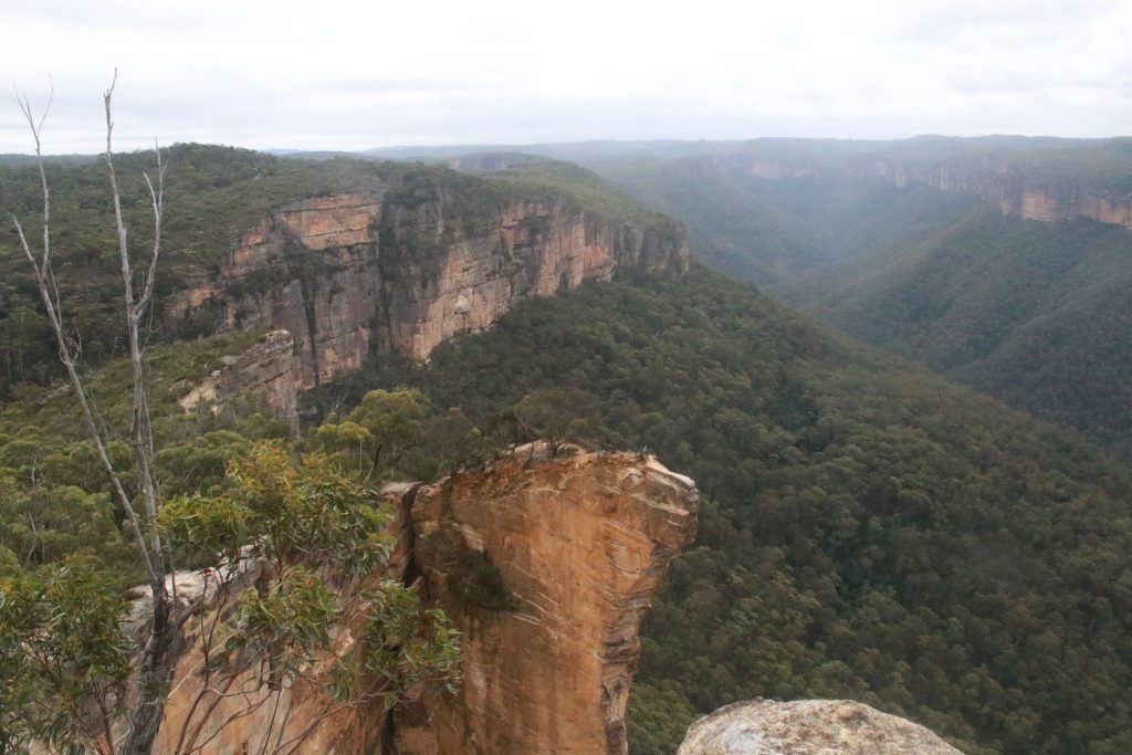
The Hanging Rock in the Blue Mountains is a huge sandstone that is overhanging from the main cliff. It is over 100 meters high. It is one of the most pictured rocks in the Blue Mountains. Supposedly, people used to tie ropes and hang off that rock hence the name Hanging Rock. Hanging the rock with a rope was later banned as a few people died doing that daring act.
The Hanging Rock track is ideal for mountain bikers too.

Featured in many calendars and hiking photographs, the Hanging Rock in the Blue Mountains has also been featured in the movie “The Edge“.

The ideal time to get to the Hanging Rock is during sunrise. The sunrise enhances the colours of the rock, and they make great photographs.
The Hanging Rock Trail details
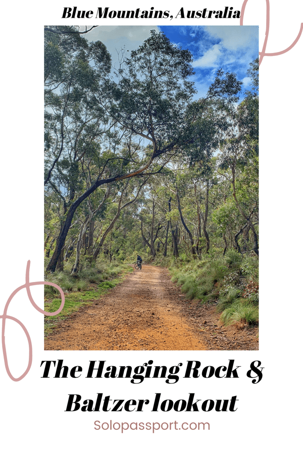
The walk to the Baltzer lookout is pretty straightforward and is along the main fire trail, which is known as the Burramoko fire trail. The lookout provides spectacular views of the Grose Valley in the Blue Mountains.
Watch out for cyclists (commonly) and national park vehicles (rarely).

Logistics of The Hanging Rock Trail
Note: There is a gap between the main trail and the hanging rock. The gap is too big and is very risky. I would not suggest attempting to jump that gap.
I have described two options below. One is when you reach the Blackhealth train station by public transport and the other when you drive to the car park. Both the trails are same, just that the Blackhealth one is a bit longer.
Option 1 – From Blackheath train station
- Starting and finishing point: Blackheath train station.
- Distance: 10 kilometres return from the Hanging Rock car park + 3 kilometres from Blackheath train station.
- Time: 3 to 3.5 hours.
- Grade: Easy, except for the steep walk from the Baltzer lookout to the Hanging Rock and back.
- Path (one way): Blackheath train station > Car park on Ridgewell Road > Follow Burramoko fire trail > Baltzer lookout > Hanging Rock. And return on the same path.
Option 2 – From the Car park on Ridgewell Road
- Starting and finishing point: Car park on Ridgewell Road.
- Distance: 10 kilometres return from the Hanging Rock car park.
- Time: 2 to 2.5 hours.
- Grade: Easy, except for the steep walk from the Baltzer lookout to the Hanging Rock and back.
- Path (one way): Car park on Ridgewell Road > Follow Burramoko fire trail > Baltzer lookout > Hanging Rock. And return on the same path.
Important Information
- There are no toilet facilities in or near the car park. There are toilets in the petrol station that is opposite to the Blackheath train station.
- Ensure to carry some snacks so you can munch along the way or at the Baltzer lookout.
- Be extra careful at the cliffs and the edges. It is a complete drop into the valley.
- It is best to avoid the trail during the rain. Even though the fire trail is okay to walk during the rain, but the edges and the path to go down to the Hanging Rock is very slippery.
- Ensure you carry sufficient water.
- Wear comfortable and sturdy shoes.
- DO NOT litter, and DO NOT smoke in the national park.
- And as I mentioned earlier, do not attempt to jump the gap between the main trail and the hanging rock. It is extremely dangerous.

How to get to the car park on Ridgewell Road?
By Road
Driving is the quickest and easiest way to get to the car park. The car park is along Ridgewell Road, about 1 to 2 kilometres from the Blackheath train station. The car park on Ridgewell Road is around 115 kilometres (2 hours drive) from Sydney.
- The car park is not monitored, and parking is absolutely free.
- There are toll roads in between the routes.
By Public transport
- Blackheath train station is the closest station, which is about 2 kilometers one way from the starting point of the walk.
- There are trains that run frequently between the city (Sydney Central) and the Blackheath station.
- More information can be found on the NSW Transport website.
Is it safe for solo female travellers?
Absolutely YES. The Hanging Rock in the Blue Mountains is very safe for solo female travellers. The only risks are at the edges, where you need to be extra cautious and careful. The path after the Baltzer lookout can become very slippery. There are people walking on the trail (even though not as many as on the other trails), so there is help.
If you love hiking, then The Blue Mountains has plenty of hiking trails suitable for all, such as Blackfellows Hand Cave (easy), Glenbrook to Red Hands Cave, The Grand Canyon (difficult), Ruined Castle (difficult), Castle Head Walk, The Six Foot track (multiday), Pulpit Rock lookout, Dantes Glen Loop walk and Valley of the Waters hike.
Generally, the trails in the Blue Mountains are safe for travellers. But there are many trails that are unmarked and do not have proper path. These trails are definitely risky and dangerous as extra precautions need to be taken at the edges of the cliffs. Also, as per Trekking and Hiking 101, it is always advisable to have a trekking buddy just so one is prepared for unexpected situations.

Closing Notes
I love the Hanging Rock trail. It is a very relaxed trail in the Blue Mountains. I have already done this track twice, and I still have a long way to go. It is also a great spot for taking beautiful Instagram pictures. I definitely recommend hiking this trail at least once.
As I mentioned earlier, the Hanging Rock trail is awesome for beginners who want to get a taste for hiking trails in the Blue mountains.
If you know any of the other trails in the Blue Mountains that are amazing and worth exploring, please drop in a comment below or write to be on Raksha.Nagaraj@Solopassport.com or Solopassport@gmail.com.

How can you support me?
You know how much I love coffee, so you can buy me a coffee – Buy me Coffee!
Or you can purchase from one of the below travel resources without any extra charge to you:
Travel Resources
Book your flight on Skyscanner.com or Trip.com
Reserve your accommodation on Stay22
Reserve your stay at a hostel on HostelWorld
Use RentalCars or DiscoverCars for hiring self-driven cars
Book your tours and travels or purchase tickets on Viator or GetYourGuide
For a universal SIM card, use DrimSim
Buy comprehensive travel insurance on SafetyWing and WorldNomads
If you liked this article and if it was helpful in your planning or travelling, do share, tweet, or pin this post.
Follow me on Instagram | Facebook | YouTube | Twitter | LinkedIn
Do you have a question? Do you want any suggestions and tips for travel, hikes, and scuba dives? Use the Subscription box below to sign up and get updates by email.
PIN for later reference


